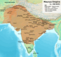
پرونده:Maurya Empire, c.250 BCE 2.png

این پیش-پیش سِراق هدائن ِقایده: ۶۴۲ × ۶۰۰ پیکسل. دیگه کیفیتون: ۲۵۷ × ۲۴۰ پیکسل | ۵۱۴ × ۴۸۰ پیکسل | ۸۲۲ × ۷۶۸ پیکسل | ۱٬۲۰۰ × ۱٬۱۲۱ پیکسل.
اصلی پرونده (۱٬۲۰۰ × ۱٬۱۲۱ پـیـکـسهل, فـایـل گـأتـی: ۲٫۲۶ مگابایت, MIME مـونـد: image/png)
فایل تاریخچه
تاریخ/زمونها سَر کلیک هاکنین تا اون گادِر ِنسخه ره هارشین.
| تاریخ/زمون | انگوس گتی | ابعاد | کارور | هارشا | |
|---|---|---|---|---|---|
| إسا | ۱۶ آوریـل ۲۰۲۴، ساعت ۰۴:۳۷ |  | ۱٬۲۰۰ در ۱٬۱۲۱ (۲٫۲۶ مگابایت) | Avantiputra7 | Reverted to version as of 11:12, 5 April 2024 (UTC) - vandalism |
| ۱۴ آوریـل ۲۰۲۴، ساعت ۰۷:۳۷ |  | ۱٬۲۰۰ در ۱٬۱۲۱ (۲٫۱۸ مگابایت) | Layman7676 | Reverted to version as of 11:12, 4 April 2024 (UTC) The map you are publishing isn't based on wha vincient Arthur really said. | |
| ۵ آوریـل ۲۰۲۴، ساعت ۱۱:۱۲ |  | ۱٬۲۰۰ در ۱٬۱۲۱ (۲٫۲۶ مگابایت) | Avantiputra7 | Reverted to version as of 08:27, 3 April 2024 (UTC) - vandalism | |
| ۴ آوریـل ۲۰۲۴، ساعت ۱۱:۱۲ |  | ۱٬۲۰۰ در ۱٬۱۲۱ (۲٫۱۸ مگابایت) | Chakravartin1929 | Reverted to version as of 05:41, 26 March 2024 (UTC) This is the true map. It depicts The mauryan map accurately. | |
| ۳ آوریـل ۲۰۲۴، ساعت ۰۸:۲۷ |  | ۱٬۲۰۰ در ۱٬۱۲۱ (۲٫۲۶ مگابایت) | Avantiputra7 | Reverted to version as of 11:06, 3 March 2024 (UTC) | |
| ۲۶ مـارس ۲۰۲۴، ساعت ۰۵:۴۱ |  | ۱٬۲۰۰ در ۱٬۱۲۱ (۲٫۱۸ مگابایت) | Chakravartin1929 | Reverted to version as of 09:06, 3 March 2024 (UTC) | |
| ۳ مـارس ۲۰۲۴، ساعت ۱۱:۰۶ |  | ۱٬۲۰۰ در ۱٬۱۲۱ (۲٫۲۶ مگابایت) | Avantiputra7 | Reverted to version as of 11:10, 29 January 2024 (UTC) | |
| ۳ مـارس ۲۰۲۴، ساعت ۰۹:۰۶ |  | ۱٬۲۰۰ در ۱٬۱۲۱ (۲٫۱۸ مگابایت) | Chakravartin1929 | Reverted to version as of 16:50, 14 December 2023 (UTC) This map is better. | |
| ۲۹ ژانویه ۲۰۲۴، ساعت ۱۱:۱۰ |  | ۱٬۲۰۰ در ۱٬۱۲۱ (۲٫۲۶ مگابایت) | Avantiputra7 | tweaked | |
| ۲۹ ژانویه ۲۰۲۴، ساعت ۰۲:۱۵ |  | ۱٬۲۰۰ در ۱٬۱۲۱ (۲٫۲۶ مگابایت) | Avantiputra7 | adjusted borders to match Joppen's, and as per discussions added labelling of provinces |
پروندهی استفاده بیّن
این صفحه لینک هِدانه این فایل ره:
پروندهی ِهمه جایی استفاده بییین
این ویکیون هم این پرونده جه استفاده کانّه:
- کاربرد am.wikipedia.org دله
- کاربرد ar.wikipedia.org دله
- کاربرد azb.wikipedia.org دله
- کاربرد ba.wikipedia.org دله
- کاربرد be.wikipedia.org دله
- کاربرد bg.wikipedia.org دله
- کاربرد bn.wikipedia.org دله
- کاربرد ckb.wikipedia.org دله
- کاربرد de.wikipedia.org دله
- کاربرد en.wikipedia.org دله
- Ashoka
- Talk:History of India
- Magadha
- Maurya Empire
- Arthashastra
- Kalinga (historical region)
- Economic history of India
- Tamilakam
- Pataliputra
- Indian people
- Mahameghavahana dynasty
- Three Crowned Kings
- List of rulers of Odisha
- Talk:India/Archive 39
- Talk:Maurya Empire/Archive 1
- Wikipedia:Dispute resolution noticeboard/Archive 135
- User:Falcaorib
- Talk:Maurya Empire/Archive 2
- List of Maurya Emperors
- کاربرد en.wiktionary.org دله
- کاربرد es.wikipedia.org دله
- کاربرد he.wikipedia.org دله
- کاربرد hy.wikipedia.org دله
- کاربرد id.wikipedia.org دله
- کاربرد it.wikipedia.org دله
- کاربرد ja.wikipedia.org دله
- کاربرد kn.wikipedia.org دله
- کاربرد ko.wikipedia.org دله
- کاربرد lv.wikipedia.org دله
- کاربرد ml.wikipedia.org دله
- کاربرد nl.wikipedia.org دله
سراسری استفادهئون ره این پرونده جه سِراق هاده.

