
پرونده:Pluto-map-hs-2010-06-c180.jpg

این پیش-پیش سِراق هدائن ِقایده: ۶۰۰ × ۶۰۰ پیکسل. دیگه کیفیتون: ۲۴۰ × ۲۴۰ پیکسل | ۴۸۰ × ۴۸۰ پیکسل | ۷۶۸ × ۷۶۸ پیکسل | ۱٬۲۰۰ × ۱٬۲۰۰ پیکسل.
اصلی پرونده (۱٬۲۰۰ × ۱٬۲۰۰ پـیـکـسهل, فـایـل گـأتـی: ۱۹۵ کیلوبایت, MIME مـونـد: image/jpeg)
|
|
این پرونده ویکیتلمبار دله دَره. ونه دلهی بنویشتهئون (مازرونی) ره اینجه سِراق دنه. |
گزارش
| توضیح |
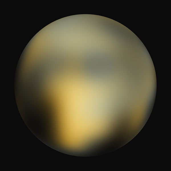
English: A best-fit color image/map of Pluto generated with the Hubble Space Telescope and advanced computers. It is unknown if the brightness differences are mountains, craters, or polar caps. |
| تاریخ | |
| منبع | Hubblesite STScI-2010-06 (New Hubble Maps of Pluto Show Surface Changes; 180 degree Longitude) |
| سازنده | NASA, ESA, and Marc W. Buie (Southwest Research Institute) |
| اجازهنومه (این فایل جه أی اٮستفاده هاکردن) |
Any web pages, publications, or any other published use of these maps should provide a legible credit line consistent with the medium that states: "Images are courtesy of Marc W. Buie, Southwest Research Institute" |
اجازهنومه
| این پرونده در مالکیت عمومی قرار دارد چرا که توسط ناسا ایجاد شده است. سیاست حق تکثیر ناسا بیان میکند که «مواد ناسا با حق تکثیر محافظت نمیشوند، مگراینکه ذکر شده باشد». (Template:PD-USGov، صفحهٔ سیاست حق تکثیر ناسا یا سیاست جیپیال استفاده از تصاویر را ببینید.) | ||
 |
هشدارها:
|
| Annotations | This image is annotated: View the annotations at Commons |
فایل تاریخچه
تاریخ/زمونها سَر کلیک هاکنین تا اون گادِر ِنسخه ره هارشین.
| تاریخ/زمون | انگوس گتی | ابعاد | کارور | هارشا | |
|---|---|---|---|---|---|
| إسا | ۴ فوریه ۲۰۱۰، ساعت ۲۳:۴۲ | | ۱٬۲۰۰ در ۱٬۲۰۰ (۱۹۵ کیلوبایت) | Kheider | == Summary == {{Information |Description={{en|1=A best-fit color image/map of Pluto generated with the Hubble Space Telescope and advanced computers. It is unknown if the brightness differences are mountains, |
پروندهی استفاده بیّن
این عکس ره هیچ جا نییشتنه
پروندهی ِهمه جایی استفاده بییین
این ویکیون هم این پرونده جه استفاده کانّه:
- کاربرد ar.wikipedia.org دله
- کاربرد be.wikipedia.org دله
- کاربرد cs.wikipedia.org دله
- کاربرد cs.wikiversity.org دله
- کاربرد de.wikipedia.org دله
- کاربرد en.wikipedia.org دله
- User:JohnOwens
- User:Clementi
- User:Steve Farrell
- User:DJRaveN4x
- User:Mitternacht90
- User:5aret/5aret's userboxes2
- User:Jimbobalina2005~enwiki
- User:Maelstromm
- User:Mckinlayr
- User:Andante1980
- User:Girla PurpleHeart
- User:Rwflammang
- User:Mathmagic
- User:Rursus
- User:Rkeysone
- User:MissionControl
- User:Buurma
- User:Thaimodz
- User:Lass Lethe
- User:Fjbfour
- User:Rursus/Pluto Dont Care Dwarf Planet Not
- User:Mekmtl
- User:Catalyst2007
- User:Praveen pillay
- User:Steve Farrell/userboxes
- User:Nincubus99x
- User:Cotard
- User:Mendors
- User:Derg999
- User:Radman622
- User:Pulsar06
- User:Themcman1/Userboxes
- User:Saber girl08/userboxen
- User:Andante1980/userbox
- User:Pastel kitten
- User:Countincr
- User:JCSeer
- User:Truncatedcone
- User:DareonClearwater
- User:LadyMage
- User:Samurai3
- User:Mandrke/UserBoxes
- User:Taskforce 58
سراسری استفادهئون ره این پرونده جه سِراق هاده.