
پرونده:Un-rwanda.png

اصلی پرونده (۳٬۰۳۸ × ۲٬۲۵۸ پـیـکـسهل, فـایـل گـأتـی: ۱٫۴۳ مگابایت, MIME مـونـد: image/png)
|
|
این پرونده ویکیتلمبار دله دَره. ونه دلهی بنویشتهئون (مازرونی) ره اینجه سِراق دنه. |
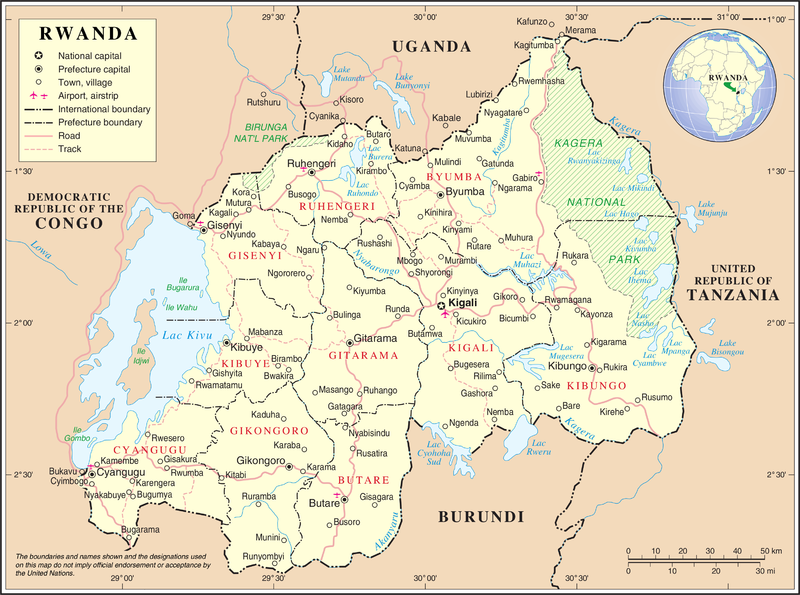
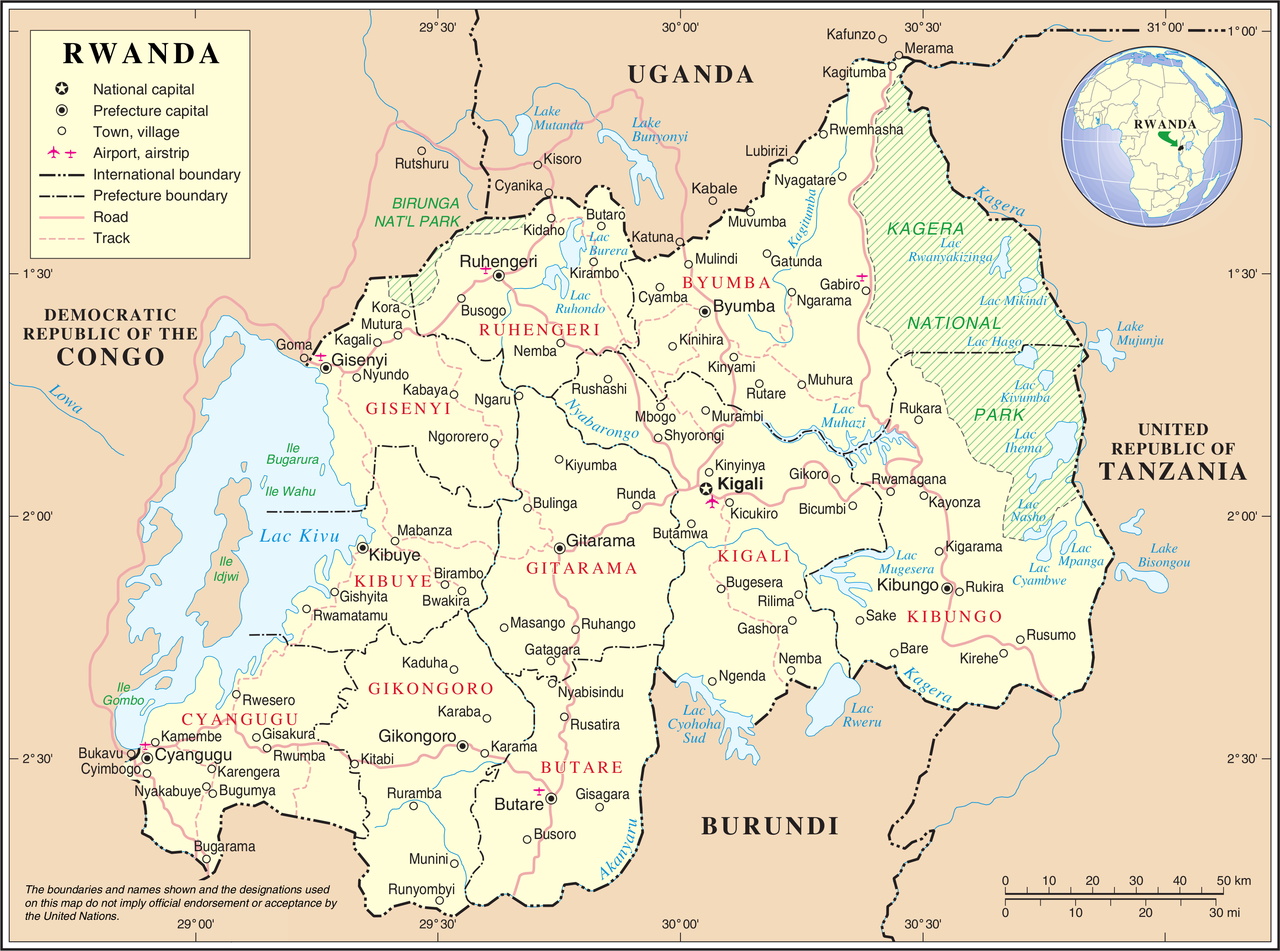
| توضیح | United Nations Map showing Rwanda prior to the reform of its subdivision in 2006 | |||
| منبع | ||||
| سازنده | United Nations Cartographic Section | |||
| اجازهنومه (این فایل جه دِباره استفاده هاکردن) |
|

فایل تاریخچه
تاریخ/زمونها سَر کلیک هاکنین تا اون گادِر ِنسخه ره هارشین.
| تاریخ/زمون | انگوس گتی | ابعاد | کارور | هارشا | |
|---|---|---|---|---|---|
| إسا | ۲۴ اکتبر ۲۰۰۷، ساعت ۰۲:۱۱ | | ۳٬۰۳۸ در ۲٬۲۵۸ (۱٫۴۳ مگابایت) | Jeroen | {{UN map}} Category:Maps of Rwanda |
پروندهی استفاده بیّن
این صفحه لینک هِدانه این فایل ره:
پروندهی ِهمه جایی استفاده بییین
این ویکیون هم این پرونده جه استفاده کانّه:
- کاربرد avk.wikipedia.org دله
- کاربرد ca.wikipedia.org دله
- کاربرد ckb.wikipedia.org دله
- کاربرد en.wikipedia.org دله
- کاربرد fa.wikipedia.org دله
- کاربرد fr.wikipedia.org دله
- کاربرد id.wikipedia.org دله
- کاربرد ja.wikipedia.org دله
- کاربرد mg.wikipedia.org دله
- کاربرد nl.wikipedia.org دله
- کاربرد no.wikipedia.org دله
- کاربرد pl.wiktionary.org دله
- کاربرد ru.wikipedia.org دله
- کاربرد rw.wikipedia.org دله
- کاربرد uk.wikipedia.org دله
- کاربرد wa.wikipedia.org دله
- کاربرد www.wikidata.org دله