
پرونده:Bayou La Batre harbor aerial view.jpg

این پیش-پیش سِراق هدائن ِقایده: ۸۰۰ × ۵۳۳ پیکسل. دیگه کیفیتون: ۳۲۰ × ۲۱۳ پیکسل | ۶۴۰ × ۴۲۷ پیکسل | ۱٬۰۲۴ × ۶۸۳ پیکسل | ۱٬۵۰۰ × ۱٬۰۰۰ پیکسل.
اصلی پرونده (۱٬۵۰۰ × ۱٬۰۰۰ پـیـکـسهل, فـایـل گـأتـی: ۷۹۶ کیلوبایت, MIME مـونـد: image/jpeg)
|
|
این پرونده ویکیتلمبار دله دَره. ونه دلهی بنویشتهئون (مازرونی) ره اینجه سِراق دنه. |
| توضیح |
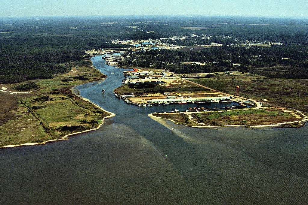
English: Aerial view of the harbor entrance from the Gulf of Mexico at Bayou La Batre, Alabama, USA. View is to the northwest.
Coordinates: 30°23′1.27″N 88°16′16″W / 30.3836861°N 88.27111°W |
|||
| مکان | Bayou La Batre, Alabama, USA | |||
| تاریخ | (Caveat: Dates provided by U.S. Army Corps of Engineers Digital Visual Library are not reliable and are often wrong.) | |||
| منبع |
U.S. Army Corps of Engineers Digital Visual Library Image page Image description page Digital Visual Library home page |
|||
| سازنده | Adrien Lamarre, U.S. Army Corps of Engineers | |||
| اجازهنومه (این فایل جه أی اٮستفاده هاکردن) |
|
فایل تاریخچه
تاریخ/زمونها سَر کلیک هاکنین تا اون گدِر ِنسخه ره هارشین.
| تاریخ/زمون | انگوسگتی | ابعاد | کارور | توضیح | |
|---|---|---|---|---|---|
| إسا | ۲۸ آوریل ۲۰۰۷، ساعت ۰۵:۰۶ | | ۱٬۵۰۰ در ۱٬۰۰۰ (۷۹۶ کیلوبایت) | DanMS | {{Information | Description = {{en|Aerial view of the harbor entrance from the Gulf of Mexico at Bayou La Batre, Alabama, USA. View is to the northwest.}} Coordinates: {{Coor dms|30|23|1.27|N|88|16|16|W|type:city|display=inline}} | Source = U.S |
پروندهی استفاده
این صفحه لینک هِدانه این فایل ره:
پروندهیِ گِردِ استفادهئون
این ویکیون هم این پرونده جه استفاده کانّه:
- کاربرد ar.wikipedia.org دله
- کاربرد arz.wikipedia.org دله
- کاربرد ca.wikipedia.org دله
- کاربرد ceb.wikipedia.org دله
- کاربرد ce.wikipedia.org دله
- کاربرد cy.wikipedia.org دله
- کاربرد da.wikipedia.org دله
- کاربرد de.wikipedia.org دله
- کاربرد de.wikivoyage.org دله
- کاربرد en.wikipedia.org دله
- کاربرد es.wikipedia.org دله
- کاربرد eu.wikipedia.org دله
- کاربرد fr.wikipedia.org دله
- کاربرد ht.wikipedia.org دله
- کاربرد hu.wikipedia.org دله
- کاربرد io.wikipedia.org دله
- کاربرد it.wikipedia.org دله
- کاربرد lld.wikipedia.org دله
- کاربرد no.wikipedia.org دله
- کاربرد pl.wikipedia.org دله
- کاربرد pt.wikipedia.org دله
- کاربرد sh.wikipedia.org دله
- کاربرد sr.wikipedia.org دله
- کاربرد tt.wikipedia.org دله
- کاربرد uk.wikipedia.org دله
- کاربرد uz.wikipedia.org دله
- کاربرد vi.wikipedia.org دله
- کاربرد www.wikidata.org دله
- کاربرد zh-min-nan.wikipedia.org دله