
پرونده:Keyesport Illinois with Carlyle Lake filling.jpg
این پیش-پیش سِراق هدائن ِقایده: ۸۰۰ × ۵۳۳ پیکسل. دیگه کیفیتون: ۳۲۰ × ۲۱۳ پیکسل | ۶۴۰ × ۴۲۷ پیکسل | ۱٬۰۲۴ × ۶۸۳ پیکسل | ۱٬۵۰۰ × ۱٬۰۰۰ پیکسل.
اصلی پرونده (۱٬۵۰۰ × ۱٬۰۰۰ پـیـکـسهل, فـایـل گـأتـی: ۲۸۷ کیلوبایت, MIME مـونـد: image/jpeg)
|
|
این پرونده ویکیتلمبار دله دَره. ونه دلهی بنویشتهئون (مازرونی) ره اینجه سِراق دنه. |
| توضیح |
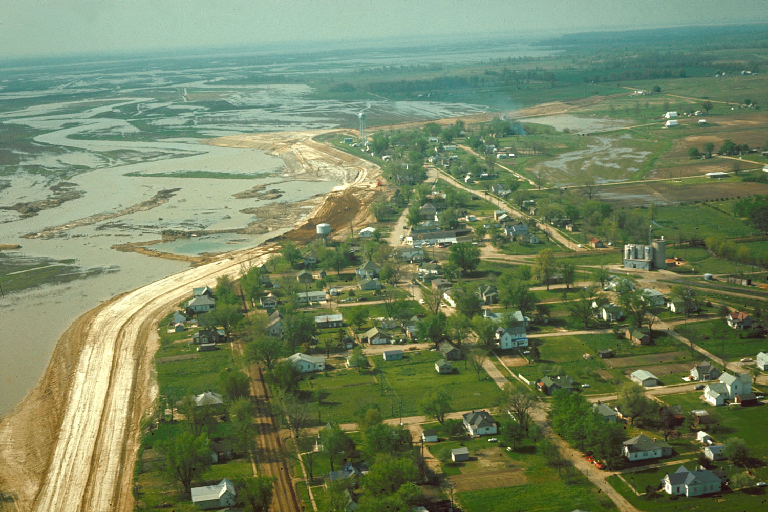
English: Aerial view of Keyesport, Illinois, USA. The photograph was taken in 1967 or 1968 after the Carlyle Lake Dam had been completed and Carlyle Lake was filling. The town now lies directly on the lakeshore. |
|||
| تاریخ | حوالی ۱۹۶۸ | |||
| منبع |
U.S. Army Corps of Engineers Digital Visual Library Image page Image description page Digital Visual Library home page |
|||
| سازنده | U.S. Army Corps of Engineers, photographer not specified or unknown | |||
| اجازهنومه (این فایل جه أی اٮستفاده هاکردن) |
|
|||
| مکان | Keyesport, Illinois, USA |
| مختصات دوربین | | محل قرارگیری این نگاره و سایر نگارهها در: نقشهٔ شهری باز |
|---|
فایل تاریخچه
تاریخ/زمونها سَر کلیک هاکنین تا اون گدِر ِنسخه ره هارشین.
| تاریخ/زمون | انگوسگتی | ابعاد | کارور | توضیح | |
|---|---|---|---|---|---|
| إسا | ۷ آوریل ۲۰۰۷، ساعت ۲۱:۰۱ | | ۱٬۵۰۰ در ۱٬۰۰۰ (۲۸۷ کیلوبایت) | DanMS | {{Information | Description = {{en|Aerial view of Keyesport, Illinois, USA. The photograph was taken in 1967 or 1968 after the Carlyle Lake Dam had been completed and Carlyle Lake was filling. The town now lies directly on the lakeshore.}} | So |
پروندهی استفاده
این صفحه لینک هِدانه این فایل ره:
پروندهیِ گِردِ استفادهئون
این ویکیون هم این پرونده جه استفاده کانّه:
- کاربرد ar.wikipedia.org دله
- کاربرد ca.wikipedia.org دله
- کاربرد ceb.wikipedia.org دله
- کاربرد cy.wikipedia.org دله
- کاربرد en.wikipedia.org دله
- کاربرد es.wikipedia.org دله
- کاربرد eu.wikipedia.org دله
- کاربرد fr.wikipedia.org دله
- کاربرد ht.wikipedia.org دله
- کاربرد it.wikipedia.org دله
- کاربرد lld.wikipedia.org دله
- کاربرد pl.wikipedia.org دله
- کاربرد pt.wikipedia.org دله
- کاربرد sr.wikipedia.org دله
- کاربرد uk.wikipedia.org دله
- کاربرد vi.wikipedia.org دله
- کاربرد www.wikidata.org دله
- کاربرد zh-min-nan.wikipedia.org دله
- کاربرد zh.wikipedia.org دله