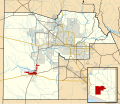
پرونده:Maricopa County Incorporated and Planning areas Gila Bend highlighted.svg
نما

حجم پیشنمایش PNG این SVG file:۶۹۴ × ۵۹۹ پیکسل دیگه کیفیتون: ۲۷۸ × ۲۴۰ پیکسل | ۵۵۶ × ۴۸۰ پیکسل | ۸۸۹ × ۷۶۸ پیکسل | ۱٬۱۸۵ × ۱٬۰۲۴ پیکسل | ۲٬۳۷۱ × ۲٬۰۴۸ پیکسل | ۹۴۰ × ۸۱۲ پیکسل.
اصلی پرونده (اسویجی ِپرونده، ابعاد ۹۴۰ × ۸۱۲ پیکسل جه، پرونده قایده: ۱٫۰۵ مگابایت)
فایل تاریخچه
تاریخ/زمونها سَر کلیک هاکنین تا اون گدِر ِنسخه ره هارشین.
| تاریخ/زمون | انگوسگتی | ابعاد | کارور | توضیح | |
|---|---|---|---|---|---|
| إسا | ۲۰ مه ۲۰۱۱، ساعت ۰۶:۲۸ |  | ۹۴۰ در ۸۱۲ (۱٫۰۵ مگابایت) | Ixnayonthetimmay | Uploading new version |
| ۳۰ آگوست ۲۰۰۸، ساعت ۰۴:۰۸ |  | ۹۰۰ در ۸۰۰ (۴۱۳ کیلوبایت) | Ixnayonthetimmay | == Summary == {{Information |Description=This map shows the incorporated areas and unincorporated areas in Maricopa County, Arizona. [[:en:Gila Bend, Arizona | |
| ۱۶ سپتامبر ۲۰۰۷، ساعت ۰۰:۲۶ |  | ۹۰۰ در ۸۰۰ (۳۸۴ کیلوبایت) | Ixnayonthetimmay | == Summary == {{Information |Description=This map shows the incorporated areas in Maricopa County, Arizona. It also shows the boundaries for the municipal planning areas. [[:en:Gila Ben | |
| ۲۸ مه ۲۰۰۷، ساعت ۰۹:۵۸ |  | ۹۰۰ در ۷۸۰ (۳۲۹ کیلوبایت) | Ixnayonthetimmay | ||
| ۲۲ مه ۲۰۰۷، ساعت ۰۰:۰۵ |  | ۹۰۰ در ۷۸۰ (۳۱۸ کیلوبایت) | Ixnayonthetimmay | ||
| ۳۰ ژانویه ۲۰۰۷، ساعت ۰۵:۰۳ |  | ۹۰۴ در ۷۵۸ (۱۸۹ کیلوبایت) | Ixnayonthetimmay | {{Information |Description=This map shows the incorporated areas in Maricopa County, Arizona, highlighting Gila Bend in red. It also shows the boundaries for th |
پروندهی استفاده
این صفحه لینک هِدانه این فایل ره:
پروندهیِ گِردِ استفادهئون
این ویکیون هم این پرونده جه استفاده کانّه:
- کاربرد ar.wikipedia.org دله
- کاربرد ca.wikipedia.org دله
- کاربرد cy.wikipedia.org دله
- کاربرد de.wikipedia.org دله
- کاربرد eu.wikipedia.org دله
- کاربرد fa.wikipedia.org دله
- کاربرد fr.wikipedia.org دله
- کاربرد ht.wikipedia.org دله
- کاربرد it.wikipedia.org دله
- کاربرد pt.wikipedia.org دله
- کاربرد sr.wikipedia.org دله
- کاربرد tt.wikipedia.org دله
- کاربرد www.wikidata.org دله
- کاربرد zh-min-nan.wikipedia.org دله
